How ebike hire can bring ‘public transport’ back to old railway routes.
Many former railway lines have been turned into cycle and walking paths. This article explores one particular example where the addition of e-bike hire stations has brought public transport back to the line.
The Route
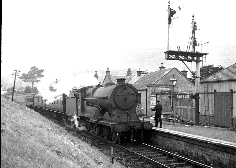
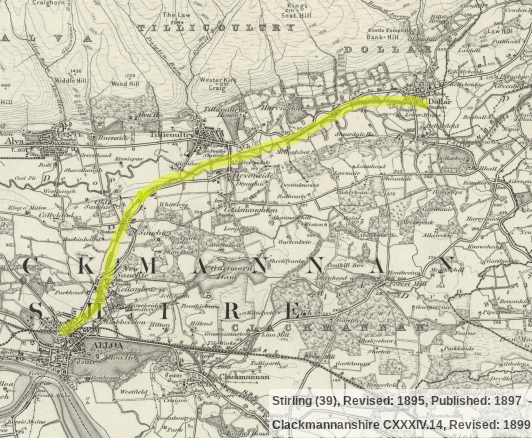
The Devon Valley railway in central Scotland closed to passengers in 1964, and closed completely in 1973. The railway ran between the two towns of Alloa and Kinross, and later for freight only between Alloa and Dollar.
The line was re-opened as National Cycle Network Route 767, and also forms part of the ‘Devon Way’ walking route. The route between Alloa and Dollar is around 6 miles long.
Creating National Cycle Network Route 767 secured the majority of the original railway alignment for the benefit of future generations, and kept the history of the line alive. The route is used by walkers, cyclists and horse riders.

Excellent signage along the route and multiple access points. 
Road bridges along the route. Good tree cover provides rain protection.
The bikes
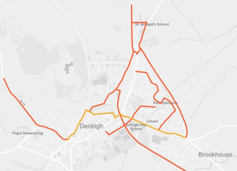
In 2019 the electric bike hire scheme known as ‘Forth Bike’ introduced hire stations at Alloa, Dollar, and at a town about half way between, Tillicoultry. For the first time in 55 years, the line provided a public transport service again.
It is now possible to get the mainline to Alloa train station, and change for an ebike to complete your journey up the old branch line.

The electrically assisted ebikes can be hired by registered users, by tapping the handlebars with a provided user card. Alternatively a mobile app is available. The app is particularly useful for visitors.
The ebikes are very easy to use. There are no gears, and the electric assist is seamless – just start pedaling, and the motor kicks in to help whisk you away.
The Forth Bike hire scheme is also considering introducing electric assist tricycles. Tricycles will have larger carrying capacity and be suitable for those who struggle to balance a bicycle.

Clear instructions at each station 
Instruction on the handlebars 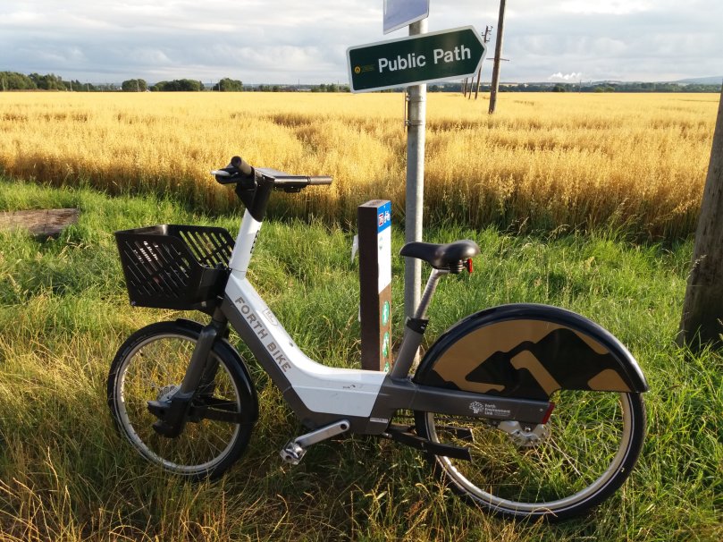
The bikes are designed to be practical
Pricing is reasonable. For visitors or one off rides, you pay £2 per 30 minute ride and 5p/min after that. Or for more regular users monthly or annual subscriptions provide unlimited free 45 minute rides at a much lower cost.
The bikes must be returned to a station at the end of hire. For some journey’s this could be a limitation. However, it also means that the bike scheme operates much more like a railway! Meaning generally speaking fewer bikes are required, and maintenance of the scheme is lower, meaning low fare prices.
Trains vs Bikes
Perhaps an odd comparison, as the two can often be combined to great affect. Replacing a train with e-bikes does at first glance seem far fetched. However, let’s consider the benefits;
- e-bikes and straight uninterrupted railway routes allow anyone to achieve a fair average speed of about 15mph with minimal effort. The entire journey from Alloa to Dollar (Terminus) takes around 25 minutes travelling at 15mph.
- e-bikes are available to start your journey at a time that suits you. There is no timetable to follow. So instead of waiting for a train, you can get on with the journey straight away.
- Converting a disused line to a multi-user path with ebikes is much easier and quicker than introducing a train service. A bike on the line is worth 10 carriages in the mind.
And the disadvantages;
- e-bikes won’t keep you dry in wet weather. However, tree coverage along the lines can make a good job of deflecting the worst of the weather.
- e-bikes, as provided by Forth Bike, can’t carry your kids. At the moment this solution is for solo travelers only. There has to be a compromise, and until e-cargo bikes are provided, this is probably the biggest.
- e-bikes, un-adapted, do not suit people with disabilities affecting their ability to use a cycle. It is possible that some adapted cycles could be made available. However, this is another area in which trains beat bikes.
Conclusion
All being equal, many people would rather get on a train than ride a bike. However, if the bike requires minimal effort, and is quicker than waiting for an alternative, then the bike is looking more attractive.
Re-opening old lines as railways is expensive, very expensive. It’s often difficult, if not impossible to make the numbers add up. This is especially true in rural areas.
Securing a railway route as a multi-user path can be difficult too, but it is generally easier, and much more easily justified financially. In itself, a multi-user path is great for walkers, cyclists and equestrians. Railway routes provide safe and attractive routes for locals and tourists. Whatever the end goal, a multi-user path is a great way to secure the route.
By adding an ebike ‘rail replacement’ service it is possible to take the route and upgrade it’s offer, moving towards providing the public transport service of old.